
Spatially explicit global current and potential forestry production value
Published:
Abstract
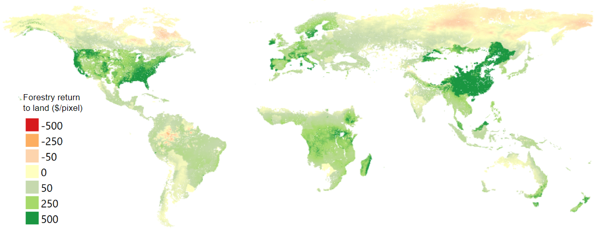
Understanding net economic returns for alternative land uses is critical in land-use decisions. Managed forestry is a major land-use class globally - occupying 540 million acres and generating 559.47 billion USD annually. Yet, we lack a consistent, spatially explicit global dataset of forestry production value. In this article, we propose a method for creating a spatially explicit dataset of global managed forestry production value. We provide estimates of both the current managed forestry production value as well as potential managed forestry production value. Using an MC2 vegetation scenario to identify forest classes, we assigned a specific biological growth function to each forest class in each global timber region. Accounting for geographic differences in local land use and scaling by the global 15-year average net primary production, we generate two maps of global timber production - (1) under current land uses and (2) under potential land use if non-forestry pixels were converted to forestry. For each pixel, we also estimate transportation costs using minute-to-market data. From this, we used Global Trade and Analysis Project (GTAP) data to subtract harvest and processing costs to get returns attributable to the land itself. This spatially explicit managed forestry production value can be used to understand land-use trade-offs and as input to land-use optimization and decision models.
Coauthors: Stephen Polasky, Brent Sohngen, Jeff Smith